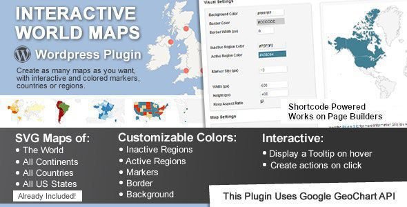
Interactive World Maps is a WordPress plugin to create as many maps as you want, with interactive and colored markers, continents, countries or regions.
Interactive World Maps Plugin Features
- A map of the entire world.
- A continent or a sub-continent.
- A country.
- A country divided by its regions.
- A state in the United States.
- The United States divided by metropolitan areas.
- A state in the United States divided by metropolitan areas.
- Background color
- Box border width and color
- Inactive regions color
- Individual colors for each active region
- Markers size
- Width and Height of the map
- Travel Websites
- Traveler Website
- Multinational Companies
- Small Companies
- NGO’s
- Infographics
Download Interactive World Maps Plugin
⚠️ Disclaimer: This plugin/theme is for personal use and practice only. Run a malware scan before use. For commercial use, purchase a license from the official website.